
The Wash
Modest But Magnificent...

Here’s a question for you.
It’s a square mouthed bay and estuary which is not only the largest of its type in England but one that also lies comfortably amongst the biggest estuaries in the whole of the United Kingdom. A vast swathe of water covering well over a quarter of a million acres that is fed by four rivers, a stunning and significant natural feature that not only contains hundreds of metres of reef within relatively shallow waters but which also boasts the second largest area of intertidal flats in England.
And as if all of that wasn’t enough, it also provides a stunning backdrop to some of the finest sunsets that you will see anywhere.
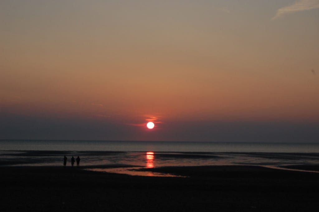
Sunset over The Wash. Stunning. (Couzens-Lake Media)
Another jewel in Norfolk’s never ending crown of delights. It is, of course, The Wash.
Fed by the rivers Nene, Welland, Witham and the Great Ouse, The Wash lies at the northwest margin of East Anglia, a constantly changing barrier that sees the coastal margins of Norfolk meet those of Lincolnshire. It’s three approximately straight edges meet a right angles with each of them being around 15 miles in length. The eastern coast of The Wash is entirely within Norfolk, extending from a point slightly north of Hunstanton to the mouth of the Great Ouse river near Kings Lynn in the south.
It is at Old Hunstanton where those stunning sunsets can often be seen. If you find yourself nearby on a long, hot and sunny June day, take a trip to ‘sunny Hunny’ and head for the beach adjacent to the Le Strange Arms Hotel and prepare to be stunned. Hunstanton has the unusual treat of an westerly facing beach that lies, regardless, on Britain’s east coast and, if the conditions are right and the waters are still and glassy, you will see a sight that you won’t easily forget.
Which is a must Norfolk experience for both the old and the new to the county.
On such evenings, the calm waters of The Wash look deceptive, almost inviting: it’s as if you could take a gentle stroll across them into the setting sun until you reached dry land again on the (nearer than it looks) Lincolnshire coast. But don’t be beguiled by the tranquil scene. Much of The Wash is so shallow, that several sandbanks that are exposed at low tide, especially along The Wash’s southern margins, which can be more than hazardous for sea going craft. Most of these sandbanks have names, with Breast Sand, Bulldog Sand, Roger Sand and Old South Sand amongst the most treacherous.
A familiar sight at the top of the famous multi coloured cliffs at Hunstanton beach would have been, and remains to this day, Old Hunstanton Lighthouse, there to give guidance and reassurance for those vessels sailing The Wash’s deceptive water-and avoid those afore mentioned sandbanks in the process. The present lighthouse was built in 1840 and was in continual use until 1922. Not that the lighthouse would have been able to do much to save the stream trawler Sheraton which, in the mid-1940’s, broke free from its mooring in those calm waters and ended up being cast upon the beach at Old Hunstanton where her fading remains can still be explored today.

Old Hunstanton Lighthouse (Rob Noble/geograph)
As far as the makeup of The Wash is concerned, DEFRA state that the entire area is comprised of 51% marine areas and sea inlets; 46% tidal rivers and estuaries, mud, sand flats and lagoons and just 3% salt marshes, pastures and steppes. But it isn’t just the visible aspect of The Wash that is of interest for, part of it’s seabed includes a delicate and rare area of reef made up from the casts of an otherwise obscure worm known as Sabellaria spinulosa. These are not, of course, the sort of eye catching and spectacular coral reefs that we are more familiar with seeing in tropical waters but they are equally as significant, standing some 30cms (nearly a foot) clear of the bottom in some places. It is the only known reef of this type occurring in UK waters.
Who knows, that coral may be growing in and around the long lost treasures that were reputedly so carelessly discarded in The Wash by the much maligned King John in the thirteenth century. Having lost much of his power to Magna Carta as well as many of his lands to the King of France, John had become a deeply unpopular monarch who had found a rare refuge for himself in Bishop’s Lynn (as King’s Lynn was then know), a town that, at the time, still had a degree of appreciation for their monarch. However, as John was taken ill during his stay in Lynn, the decision was made to take him to Lincoln (where he was even more popular), and, by definition, be even safer from those who would have his head on the end of a spike. Thus, on October 16th 1216, the King and his party attempted to cross The Wash at low tide and, although the King was successful in making the journey, the accompanying baggage train that was carrying the royal treasure was lost to the fast rising waters of a particularly high tide.

Exposed sandflats at The Wash. Does sunken treasure lurk underneath? (Richard Humphrey/geograph)
The treasure, which has been given a conservative modern day value of around £50,000,000 has never been found.
Wouldn’t it be something if a new and concerted effort was put into place to attempt to retrace his footsteps and, you never know, find a Kings long lost treasure?
The intertidal mudflats and salt marshes of The Wash are one of Britain’s most important winter feeding areas for waders and wildfowl, with large numbers of migrant birds such as grey plovers, dunlins, oystercatchers and godwits arriving in the Autumn to feed on the rich supply of food that can be sourced in the sands and mudflats. There is still time to see large flocks of waders on the mudflats on a rising tide as the ‘season’ for these birds runs from September through to May with Snettisham beach one possible destination to do just that.

Snettisham Beach. Mud, mud, glorious mud…. (Rob Fareham/geograph)
There is also a Wash National Nature Reserve which is accessible by the Peter Scott (the famous naturalist) Walk. Be aware however, that these footpaths have been put into place for a reason and that sites away from the path and in and around the seawall can be dangerous and should only be explored, if at all, with the accompanying knowledge and experience of a qualified local guide.
The Wash National Nature Reserve spreads across the southern reaches of the Wash and can be accessed along minor roads from the A17, between King’s Lynn and Sutton Bridge.
See you there. But wrap up warm!